A Dry Weekend Forecast
After a solid series of storm cycles piled up snow in our local mountains, the forecast is decidedly drier this week. Coverage is decent, and better the higher up you get, but overall the snowpack is still early season with rocks lurking, alder still standing in open areas and creeks still open on a lot of approaches.
What we're hearing this week.
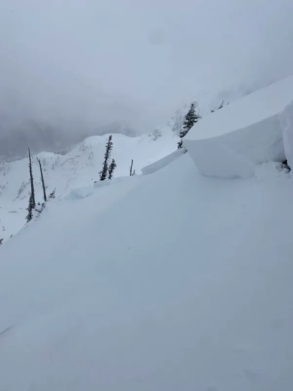
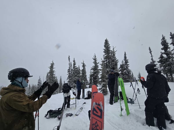
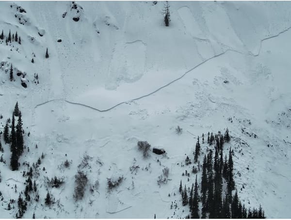
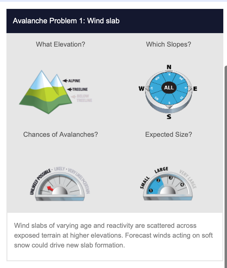
Shout out to everyone who got out and submitted a MIN report to Avalanche Canada this week. There are reports from all across the Fraser Valley from the Coquihalla, to Flora Peak, all the way to Tulameen Mountain. Overall, reports are of between 70-100cm of snow at and above treeline with 20-50cm below. Generally the lower snowpack seems to be bonding well, but some wind effect was reported in at higher elevations. This also means that snow has likely blown into the lee features and there could be lurking windslabs, which is the main problem Avalanche Canada is listing for the region.
What's Ahead
The weather heading into the weekend looks to be fairly dry with a weak high pressure system moving through BC. Winds are expected to stay up at higher elevations and the sun may pop out as we get into the weekend with freezing levels rising. Long range, there is a chance for more precipitation on the other side of this ridge.
What We're Thinking About
There are three big things on our minds as we think about getting out this weekend.
First, lower elevations are still pretty thin when it comes to snowpack. That means sporty travel below treeline both up and downhill and that open travel pathways like logging roads, pipeline cuts and trails remain some of the best filled in below treeline (provided they aren't covered in alder).
Second, we're still thinking about wind. Wind slabs could exist all over the upper mountains, so we're still looking for supported and protected terrain and venturing carefully into any avalanche terrain.
Third, we're watching the sun and the freezing level. If the sun pops out and things heat up expect the snow to get heavy and avalanche danger to rise.
And remember, if the weather shifts and we start to see precipitation before the weekend is out, that's great news for the snow, but could also mean rising hazard.
Don't forget to come join us on December 5th for an Avalanche Awareness and Trip Planning night where we'll dive deep into mapping, weather forecasting and trip planning to kick off what is starting out as an amazing season. All proceeds from tickets go to Chilliwack SAR. And, if you're interested in an AST course, they're on sale $100 off for another few days, register now and save!