Crust, Dust and Sunshine
It's been a beautiful week here in the Fraser Valley. Normally we would love that, but this time of year, we're hoping for storms. Let's get into this week's snow report.
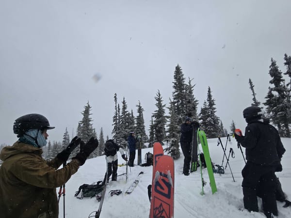
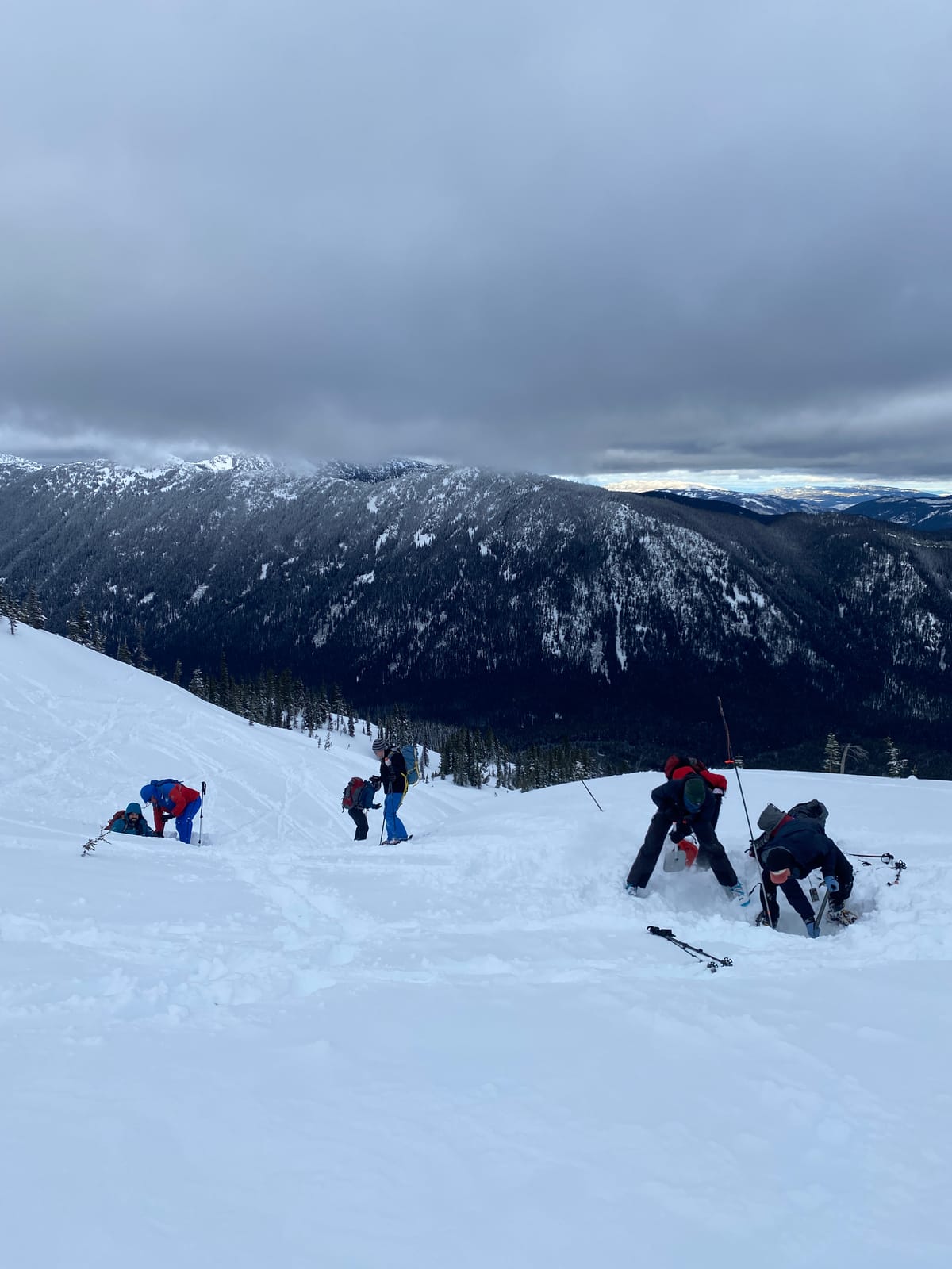
Last weekend conditions were pretty decent in our local mountains. After a week of sun and warmer temperatures, we got good pulse of fresh snow on Friday and cooler temperatures through Saturday and Sunday. We found a thin crust on most aspects and elevations with pockets of cold snow in alpine, north facing terrain.
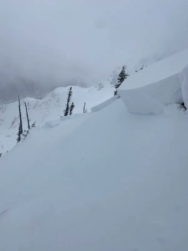
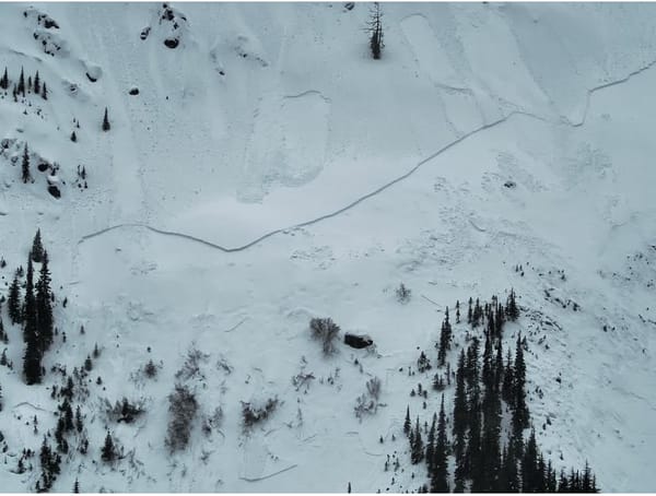
We also saw some significant wind effect by the end of the weekend, with wind pressed snow found on a variety of aspects, particularly NW facing terrain in the Coquihalla area. Steep and convex features in these areas produced some size 1 skier triggered slides and we were able to produce some stubborn results in snow profile tests.
Clear weather and wind continued through the week, keeping the windslab problem top of mind. We've also seen surface hoar forming in sheltered areas.
Looking Ahead
Today we're seeing bit of precipitation with some strong winds ahead of another high pressure ridge coming in over the weekend. The weather forecast for the foreseeable future is clearer skies and cold temperatures.
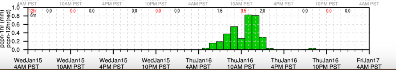
Unless this pulse of weather delivers a lot more precipitation than is anticipated, our main avalanche issue going into the weekend will be lurking windslabs. Avalanche Canada is forecasting them in the alpine on all but west and south aspects. Watch out for areas with stiff, windblown snow, especially in steep or exposed terrain.
The other thing we'll be thinking about this weekend is the sun. Even with colder temperatures, solar effect can destabilize the snowpack. Keep on the lookout for point releases, pinwheeling and softening surface snow. Steep solar slopes will be of particular concern, as will cornices which have grown with recent winds and could weaken in the sun.
In addition to these avalanche hazards, we're also thinking about conditions. Without a reset in the snow, popular areas are likely to be quite tracked out with the potential for rough, uneven and icy conditions, especially if there is a melt/freeze cycle happening. Lower elevation tree exits may require extra caution to navigate safely.
Overall, this weekend might be a good window for some exploration, but ski conditions might be challenging. Keep the avalanche hazards and weather at top of your mind while you make plans.
Other News & Upcoming Events
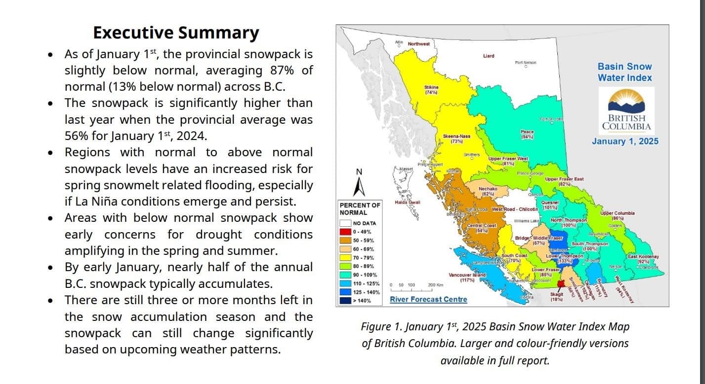
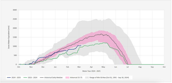
The BC Government released its first Snow Water Index update for 2025 earlier this month. It's a good news/bad news kind of situation in that we're doing far better in the Lower Fraser and South Coast regions than in 2024, but we're still below average for this time of year. There is still a lot of winter left though, and we have seen significant snow in March and April the past few winters.
On January 23rd we're hosting a Winter Social at the upcoming Mountain Town Series screening of Patagonia's newest film Papsura. The movie chronicle a team's attempt to climb and ski one of the most technical objectives in the Himalaya and will be amazing. And, we'll be sharing a "State of the Snowpack" update on conditions overall this season and you'll have a chance to find other skiers, split boarders and snowshoers in the region. It'll be a great time and a chance to find new partners for winter and spring adventures. Hope to see you there!