Dec 19 - Fraser Valley Conditions Report
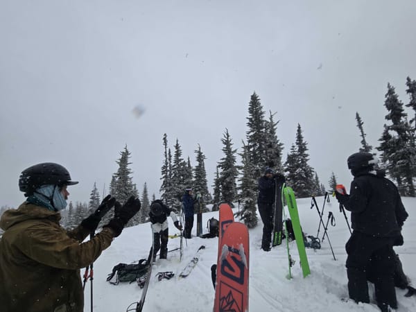
Last weekend officially kicked off Ascent's winter programs! We got out exploring the Manning Park and Coquihalla Summit backcountry and while Manning still has less snow than other local zones, we managed to find some good touring up towards Poland Lake. On Sunday, we skied 25-35cm of fresh and wind transported powder on the Coquihalla Summit.
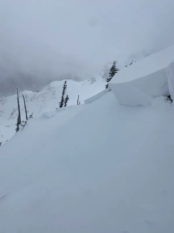
We found some soft slabs and a variable crust from the previous week's rain. The crust was quite robust at lower elevations but thinned above 1700m. A thin layer of facets lay below this crust in the spots we dug along the climb up Zoa Ridge. We weren't able to get any significant results on these layers, but at least one MIN report did find a planar shear in the same zone.
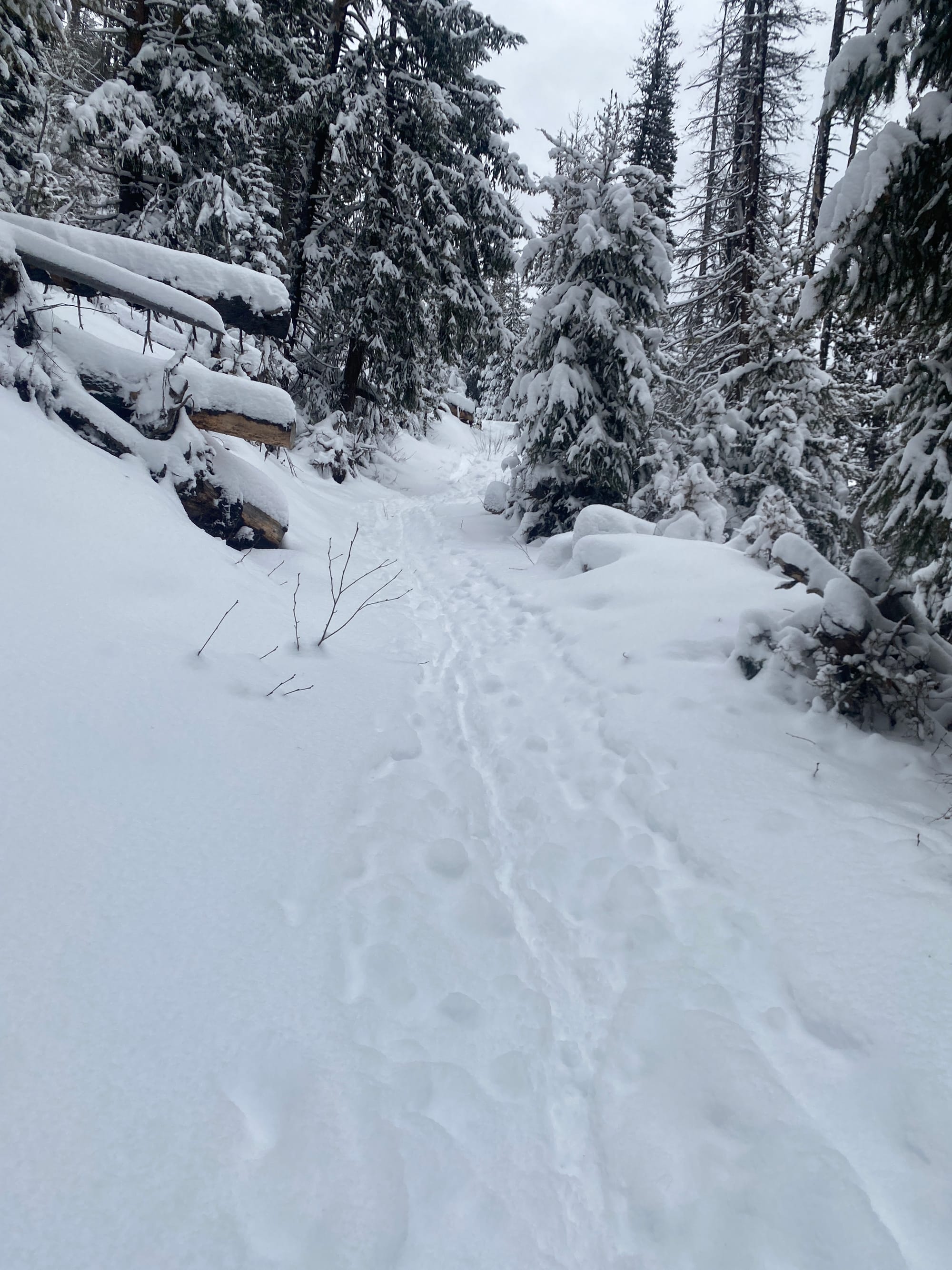
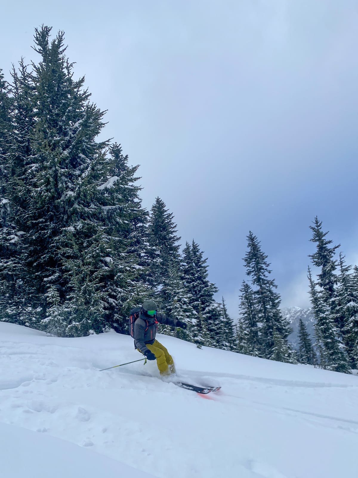
On Tuesday, we got out for some amazing storm skiing on Mt. Kelly. Despite Manning Park's lower snowpack, we found adequate coverage on the open trails below treeline for travel up and down the mountain. Skiing between the trail switchbacks isn't recommended with thick stands of alder and deadfall still making off-trail travel challenging below treeline. A MIN Report from Frosty on Sunday found similar conditions with "great powder" at higher elevations and a "terrible trail to ski" lower down.
We skied off the summit ridge towards the NE and found 30-50cm of loose dry powder over a thin crust between 1900-1700m. Precipitation was increasing and things were starting to warm up by early afternoon so conditions may be very different by now.
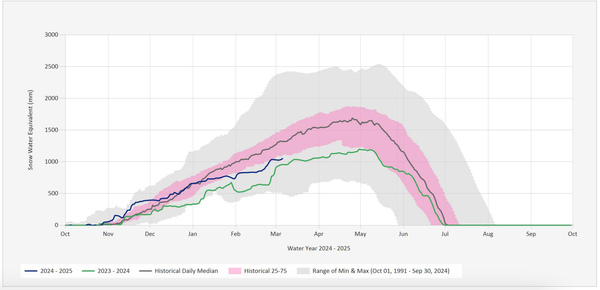
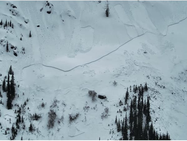
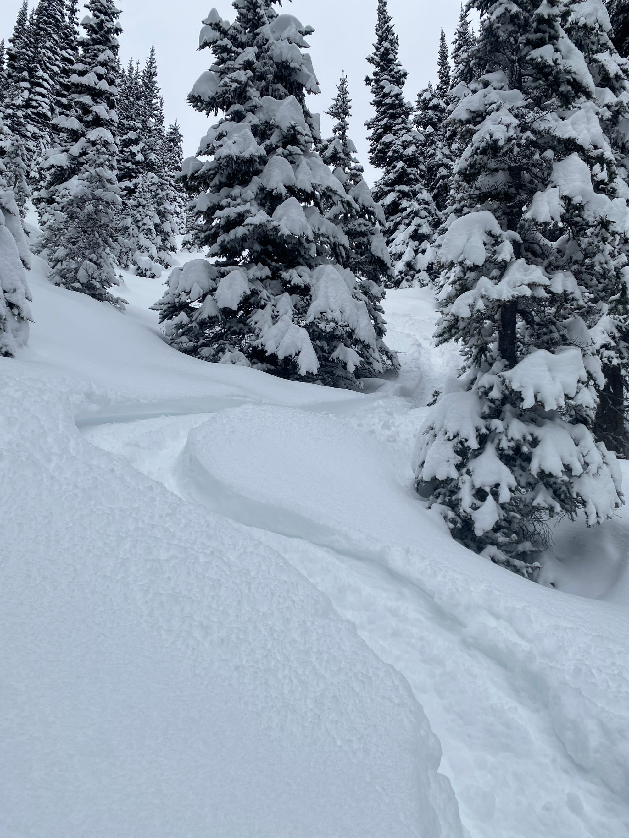
Tuesday night and early Wednesday brought another wave of moisture to the mountains dropping 20-40mm of precipitation. Below treeline most of this fell as rain with snow higher up. Significant winds also likely redistributed snow onto northerly aspects. Avalanche Canada "suspect a natural avalanche cycle took place overnight on December 17th during the peak of the storm".
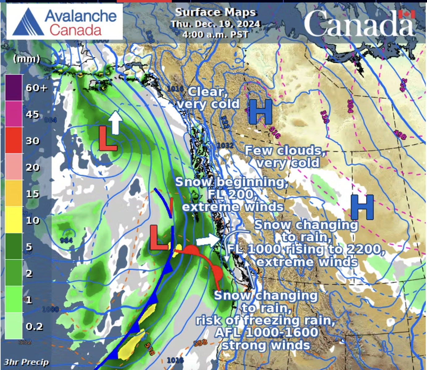
Another round of strong southerly winds and some moderate precipitation is forecast for today (Thursday the 19th) and tomorrow. The freezing level is expected to rise again and we could see freezing rain at mid-mountain elevations. Higher up strong to extreme winds will move snow around in the alpine and produce reactive slabs.
What We're Thinking About
The weather for this weekend doesn't look terrible, nor does it look amazing. Strong winds, light precipitation and mid elevation to alpine freezing levels are all on the menu.
In terms of travel, lower elevations are likely to be challenging after this week's rain and wet snow. We're preparing to deal with icy and crusty conditions in the morning and soft snow if things warm up later in the day. The rain also didn't help overall coverage, so we're still watching out for sharks.
Well be aiming to get up higher to try and find better snow and better coverage. But, if the snow is good, it also means we're dealing with increased avalanche hazard. With upwards of 40cm of new snow this week and strong winds moving it around, we'll be on the look out for reactive storm and wind slabs, particularly on north and east aspects above treeline. We're also thinking about that crust/facet layer from last weekend that could still be lurking deeper in the snowpack.
If you're planning to head out towards the Manning Park Resort backcountry this weekend, be aware that the resort has a new policy for backcountry access. Anyone crossing the resort tenure to access the backcountry will need to visit Alpine Guest Services to pick up a free backcountry pass. You can find more information here.
Don't forget, we have AST courses running most weekends this winter and have midweek courses available by request. We've also posted the next 3 dates for our Mountain Town Workshop Series with evenings diving into Map & Compass Navigation, Winter Camping & Ski Traverses and an Introduction to Backcountry First Aid.
Enjoy the Snow and Happy Holidays!