Happy New Year!
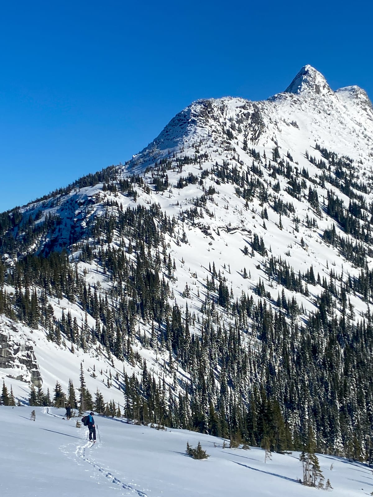
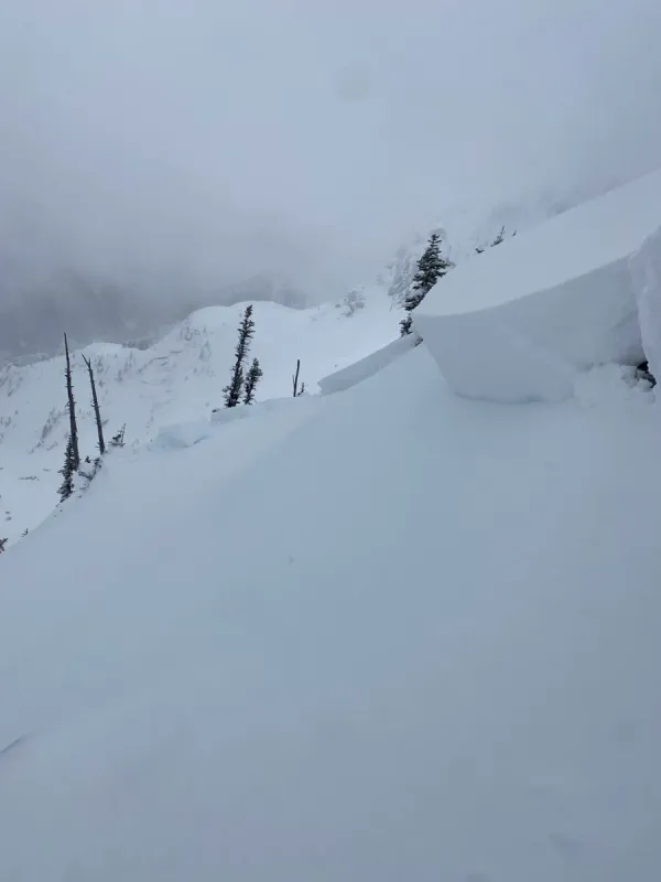
The end of 2024 and the start of 2025 has brought some great skiing. From storm days to bluebird powder days, the past week has been great for getting after it all across the North Cascades. Overall, we've seen 20-50cm's of cold, unconsolidated snow atop a crust at elevations treeline and above. In wind affected areas near ridge lines this has formed some slab properties and we have seen, and heard reports of, numerous size 1 avalanches on steep, convex features. Avalanche Canada has a number of great MIN reports from across our regions available.
Below treeline at at lower elevation approaches, conditions are improving but skiing out thickly forested areas like Needle Trees and the Thar exit are still sporty. Open areas like trails and road cuts are better filled in with the snowline in the Chilliwack River Valley reported be between 700-900 meters. If you're headed up there, chains are recommended for navigating ever changing road, ice and snow conditions.
How Is This Season Shaping Up?
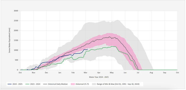
Now that we're a few weeks into the season and winter is officially here, I thought it might be helpful to look at how our snowpack is stacking up.
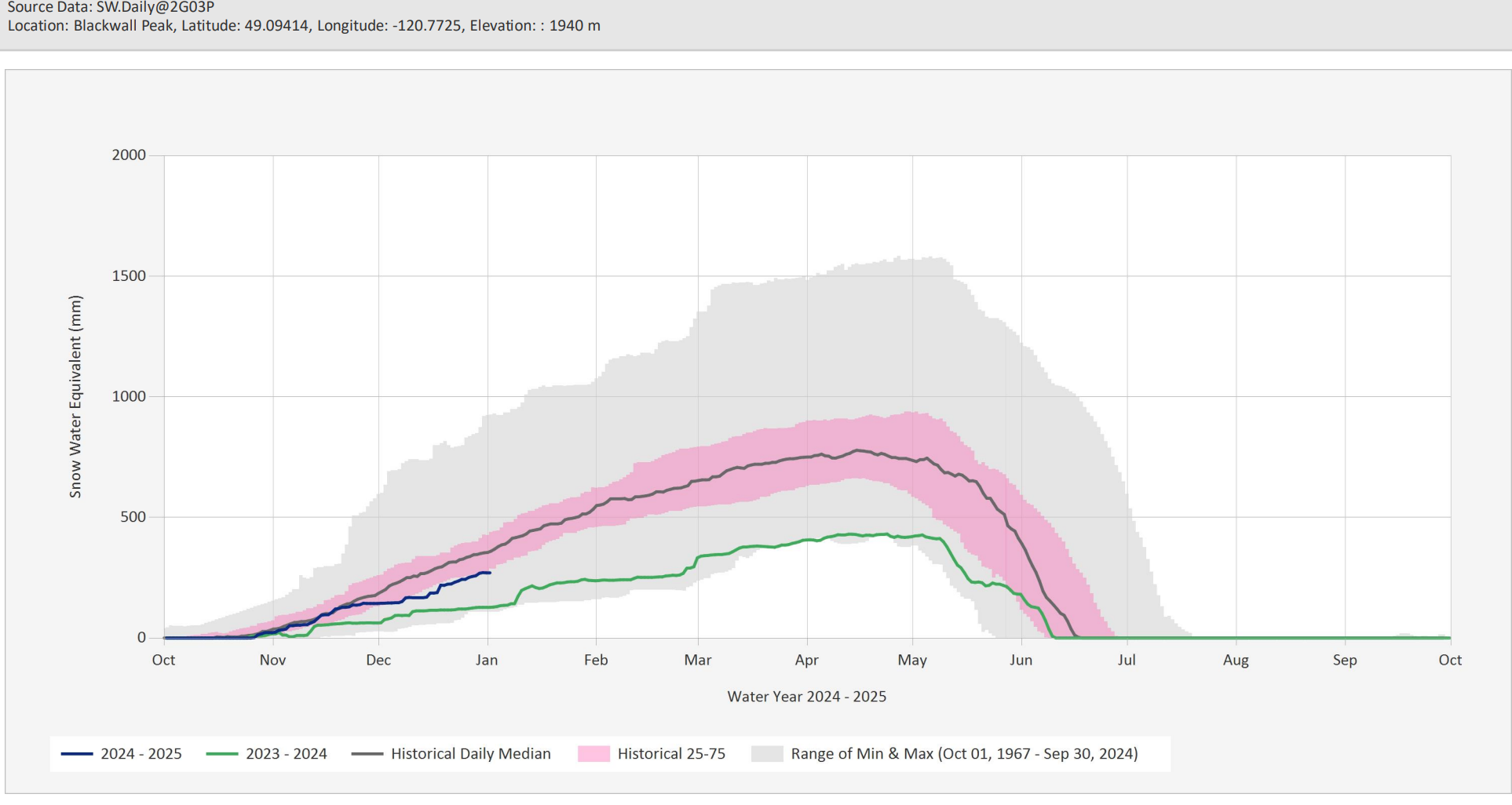
In Manning Park, things are better than last year, but still below the historical average and at the low end for snowpacks over the past 50 years.
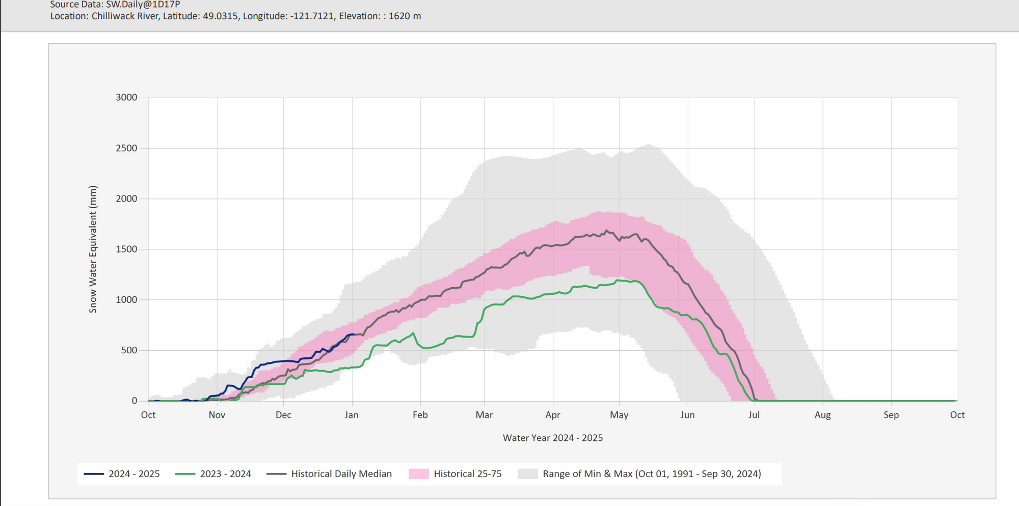
Things have been wetter up in the Chilliwack River Valley. We started well above the trend from last season and had above average snowfall for most of December. But, towards the end of the month, things slowed down a bit, tracking close to the average snowpack for the past 50 years.
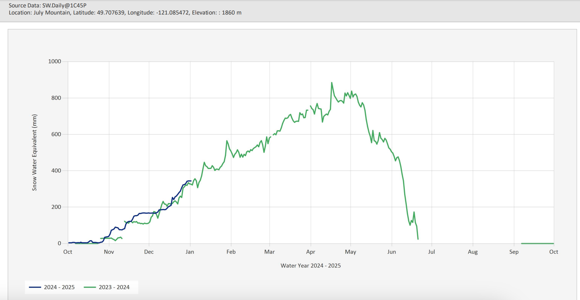
On the Coquihalla, we don't have the same historical data available as other stations, but July Mountain looks to have a similar pattern to the Chilliwack River Valley. Early season accumulations were higher than last winter, and have been slightly better for most of the weeks since.
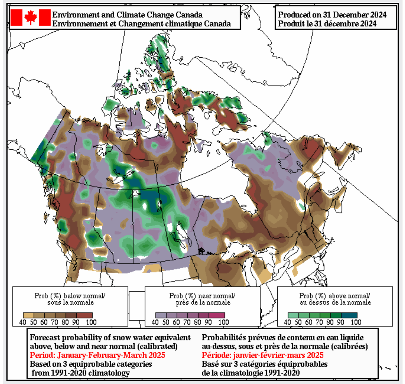
What does any of this mean? It's honestly hard to say. We started this winter hoping for a weak La Niña, which has been historically correlated with average or above average snow packs, which seems to be tracking. On the other hand, the seasonal outlook forecast published by Environment Canada on New Years Eve suggests a higher probability of "below average" snowfall for the next three months.
If I had to try to summarize things, I'd say the good news is that we're doing better than last year when it comes to ski conditions and the bad news is that we're still not sure what the rest of the winter is going to bring. But, I guess that's part of the fun of this sport.
Looking Ahead
As I'm writing this on Thursday January 2nd, the weather is starting to shift. A maritime front is inbound with precipitation on the way. Forecasts are predicting light to moderate snowfall with strong ridge top winds in our region. If we're lucky, we'll see upwards of 20+ cm's of new snow in the mountains by the end of the weekend.
With the change in weather, we're planning to dial things back after a few days pushing further into the mountains. Storm slabs could become an issue with new precipitation and strong winds will build on existing wind slab issues on lee slopes. We also still have that thick crust just below all the great powder we've been skiing, so we'll be watching to see how the upper snowpack bonds with this new precipitation. We're also expecting challenging conditions for travel up high if the forecasted winds come in as expected.
After this storm, the forecast is pretty nice for early next weeks, but watch out for rising freezing levels, sun and warmer temperatures. It's too far out to know exactly what's going to happen, but some long term forecasts have freezing levels rising above the peaks of our local mountains by the middle of next week.
If you're looking to dial in your avalanche skills in early 2025, we have courses running most weekends. And, if you're already thinking about spring traverses, basecamp trips or you want to know how to build a snow shelter for an unplanned night out, we're holding a winter camping workshop on February 6th and full overnight field course on February 22-23.
We also have a map and compass workshop coming up next week, and will be showing Patagonia's latest splitboard film Papsura as the feature for the next Mountain Town Series on January 23rd. We'll be raising money for Avalanche Canada at the event and would love to see you there.
Have a great week and an amazing start to 2025!