The Freezing Level Shuffle
After a steady walloping of snow for the past few weeks, this week saw clear skies, warmer temps and rising freezing levels. The bad news is that this melted out some of our snow and set up a crust across a lot of aspects and elevations. The good news is that this probably also helped to consolidate our base, which if we keep getting snow, will be helpful as the season progresses.
What We Saw This Week
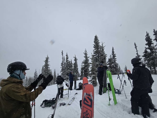
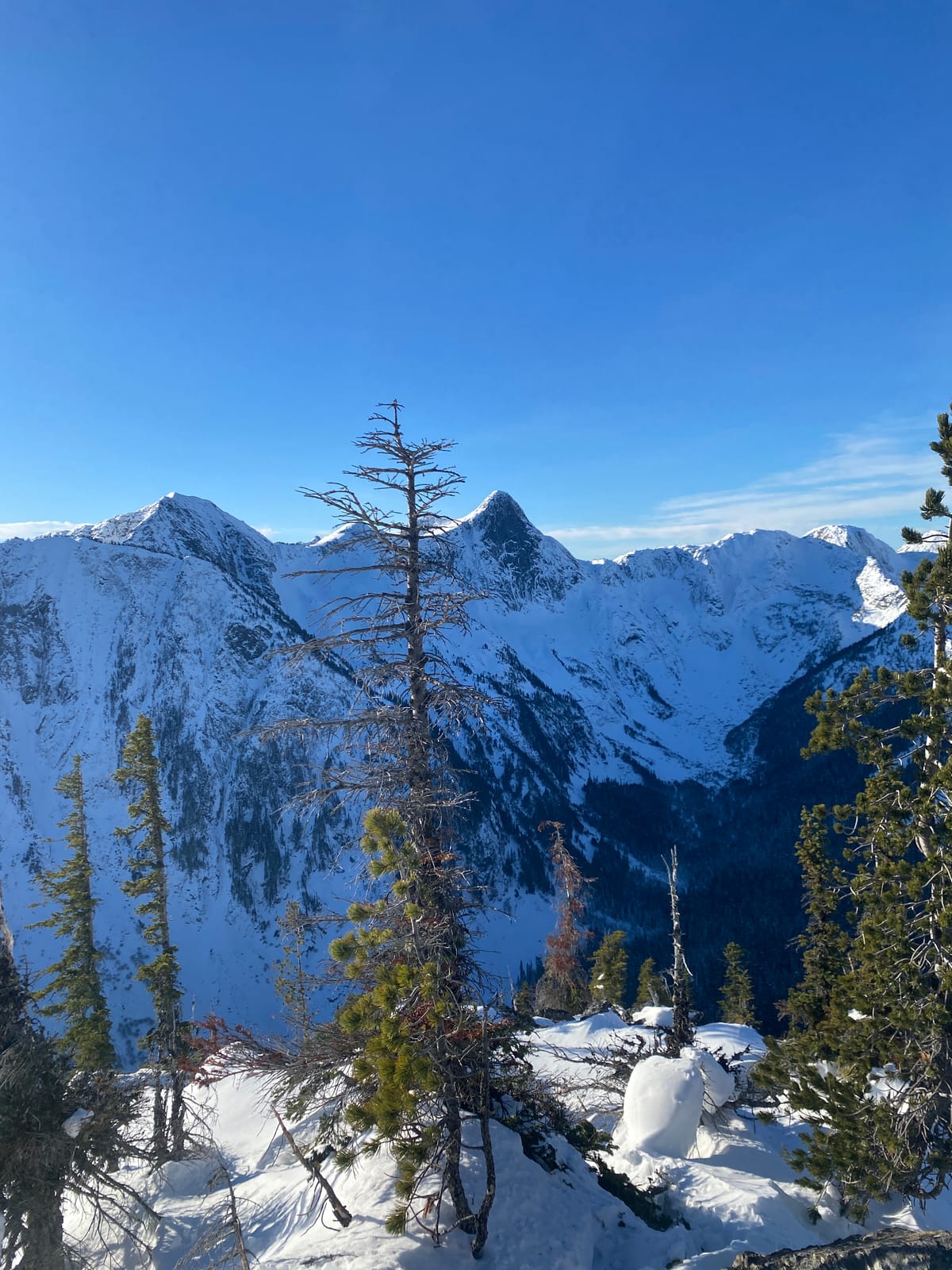
This week we spent some time up in the Coquihalla Zone checking out some of the classic backcountry touring areas.
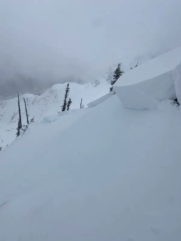
Overall, the zone is shaping up well for a great season. Areas like Zoa Ridge and Iago Bowl skied well, but coverage in the trees is still thin. Access and skinning in some of these spots remains pretty sporty with exposed roots, rocks and standing alder. Overall conditions are better above 1500m. We also took at look at some of the steeper lines, like the north aspects of Thar, but they looked quite thin with a lot of exposed rocks so we'll be waiting for a few more storms before we start thinking about those lines.
By Tuesday, solar aspects were already being heavily affected by sun and temperatures. Shaded polar aspects still held some good snow, but even these areas were starting to warm up later in the day. Those high temperatures have continued the past few days, and so by today, we'd expect most of our local areas to have a widespread sun and melt/freeze crust. There might still be some pockets of cold, dry snow hiding in high elevation, shaded areas.
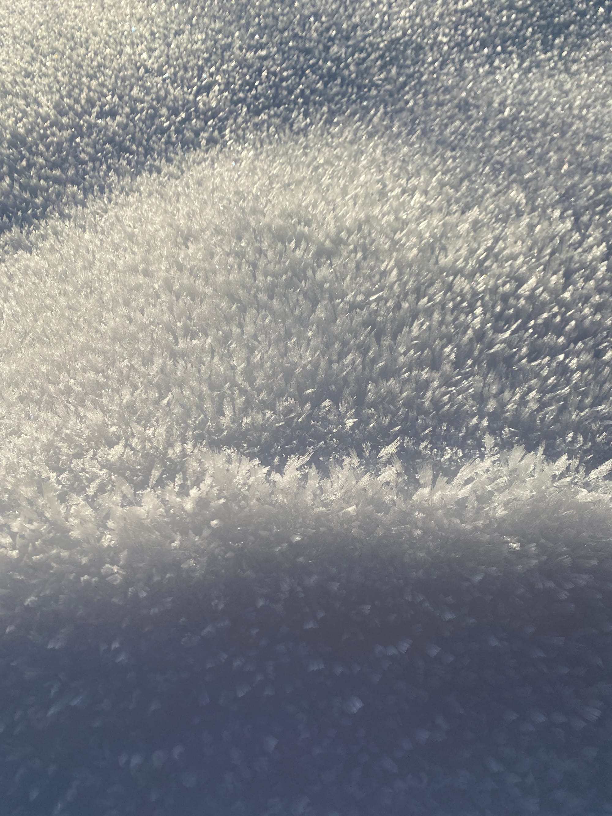
Shaded and protected areas have also developed some massive surface hoar crystals. Sun and temperatures will have done a number on a lot of this.
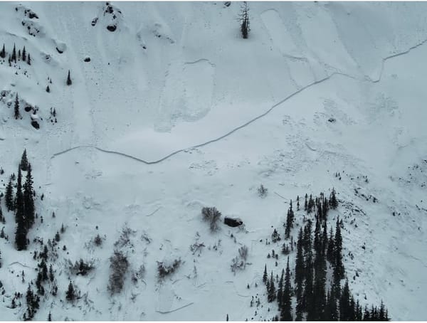
Weather stations in the Chilliwack River, Coquihalla and Manning Park zones all recorded above overnight temperatures above freezing this week and slightly declining total snow amounts as the snowpack melts and consolidates in the heat. Avalanche Canada also noted a widespread natural cycle of loose, wet avalanches and NWAC reported several Glide avalanches in the North Cascades near Mt. Baker.
What We're Thinking About
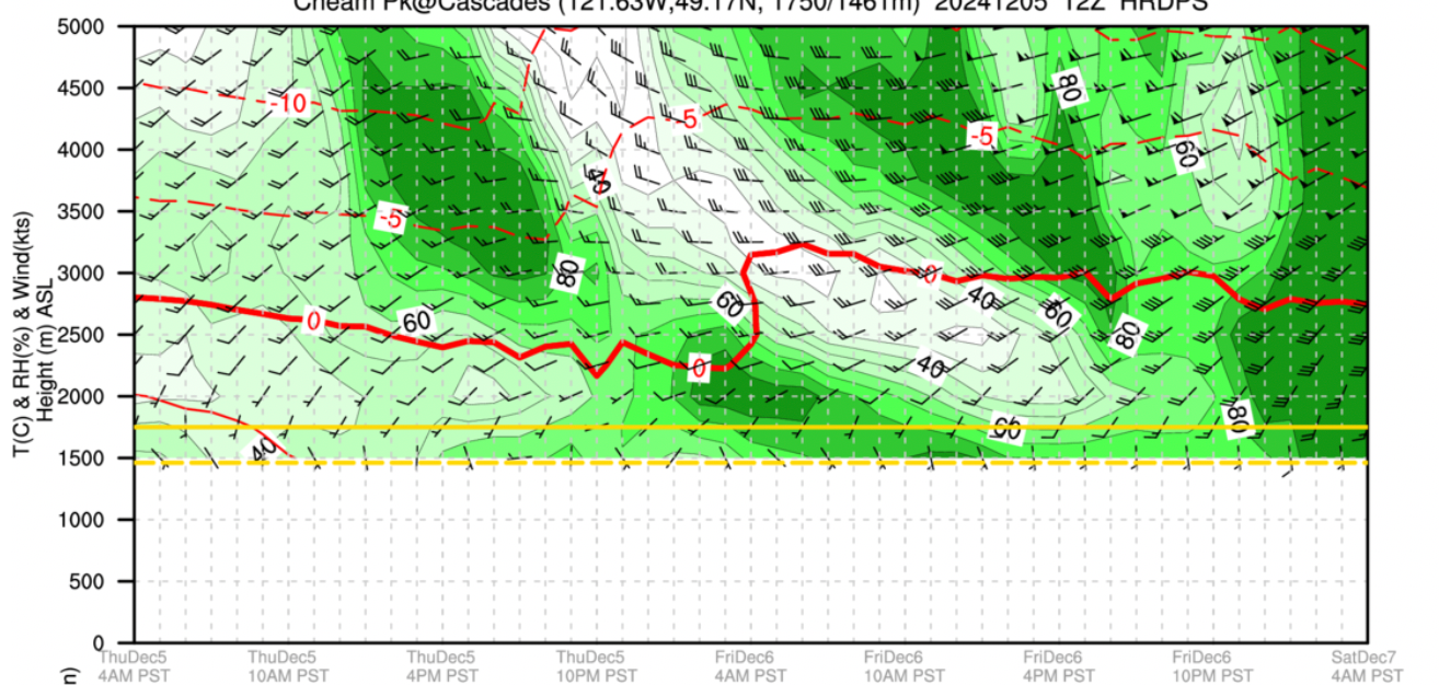
The next few days are all about moisture and freezing levels. There is an atmospheric river-like band of moisture headed our way Friday into Saturday. According to the Mountain Weather Forecast and local projects, Freezing levels are expected to spike Friday up towards 2000-3000m. Precipitation is forecast to start later in the day with anywhere from 20-60mm coming alongside powerful winds.
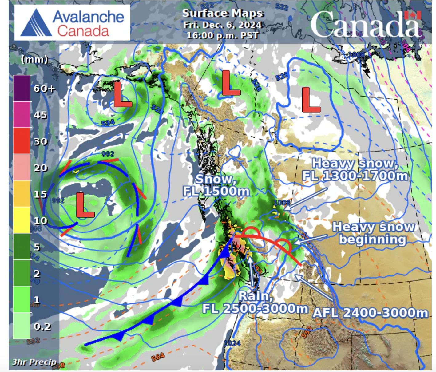
Right now, we're expecting this precipitation to arrive first as rain or wet snow at the highest elevations. The question is how fast the freezing levels drop as the bulk of the precipitation is forecast for our region through the day on Saturday.
Whatever happens, Saturday will likely be a stormy, wet day with significantly elevated avalanche hazard. Sunday, the weather may get better, but expect avalanche hazard to remain high. It's also likely that whatever happens, treeline elevations and below will get hit with a lot of rain, which could further thin out some of our lower elevation approaches into the high country.
Tracking the freezing level in real time can be difficult. We'll be watching forecasts ahead of time, but when the storm arrives, the easiest way to tell if it's raining or snowing up higher are the DriveBC webcams on the Coquihalla and in Manning Park. The resort cams from Manning Park are also a good check.
If you want to know more about different forecast tools and how to read them, join us tonight (December 5) for our workshop at Mt.Waddington's in Chilliwack or sign up for an AST course where we'll cover this all in more detail.