Winter is Back
You can feel it in the air this morning. After a long, sunny, dry stretch of weather, winter is making its way back to the North Cascades. This will bring some fresh snow, but also ramp up avalanche hazard. Let's get into it.
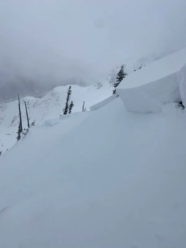
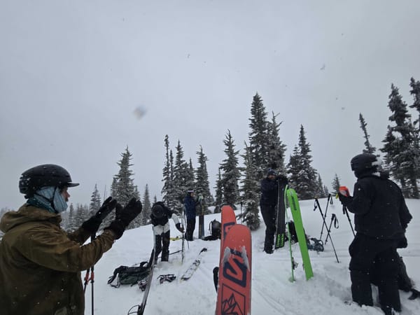
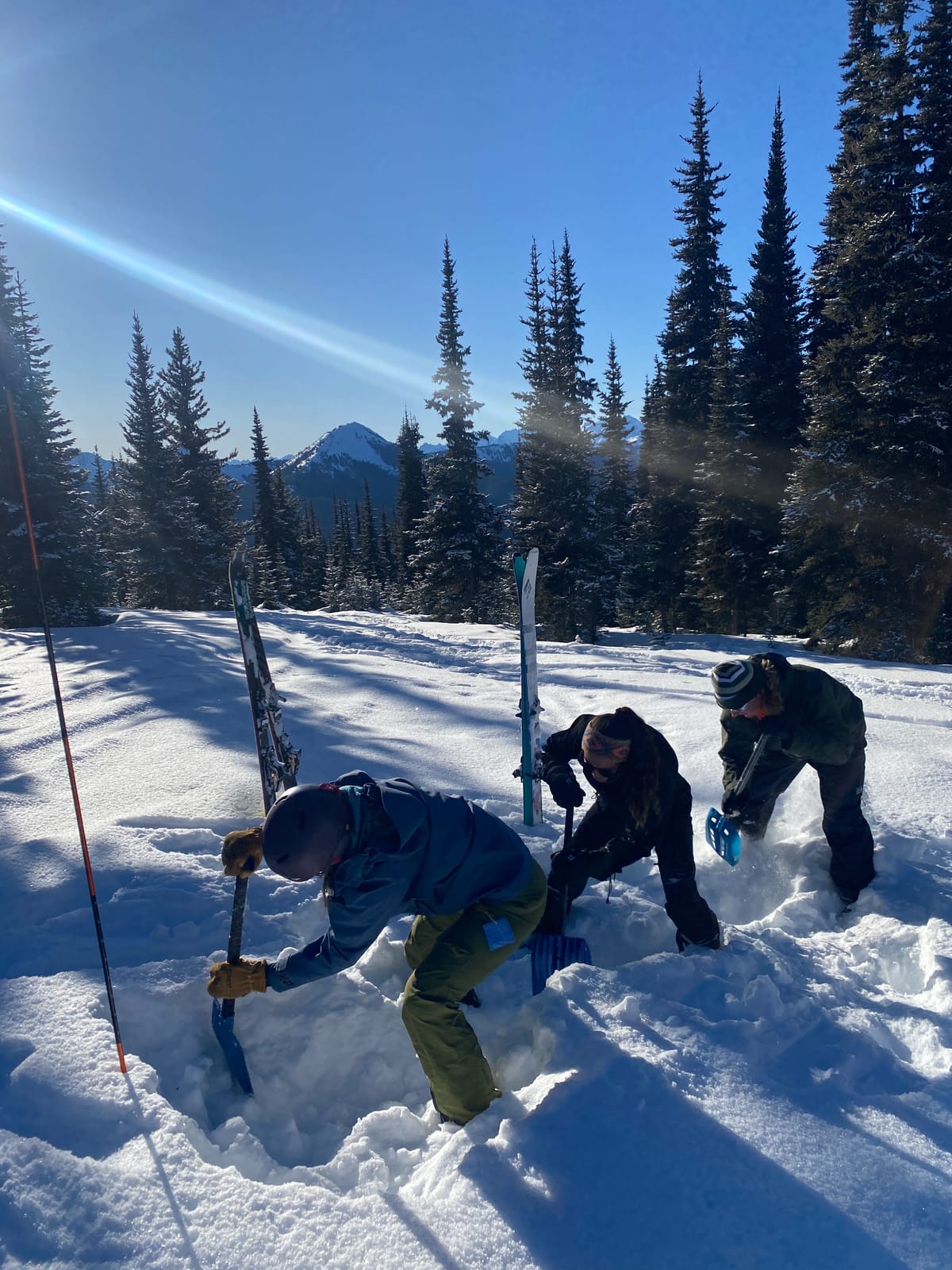
The past week we found better than expected conditions in our local mountains (we also set expectations about as low as you can). Travel below treeline was challenging to heinous depending on the aspect, elevation and tree density. In the alpine we found a mixture of crust, wind effect and decent snow in protected, shaded terrain. The weather was great for getting after bigger objectives with reports from a number of bigger local peaks like Frosty and Outram reporting decent skiing on alpine terrain.
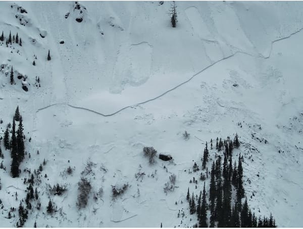
There were some reports of loose wet and loose dry avalanche activity over the weekend. Warmer temps and sun early this have established a widespread crust on most aspects. Surface hoar is also found in many sheltered areas.
Looking Ahead
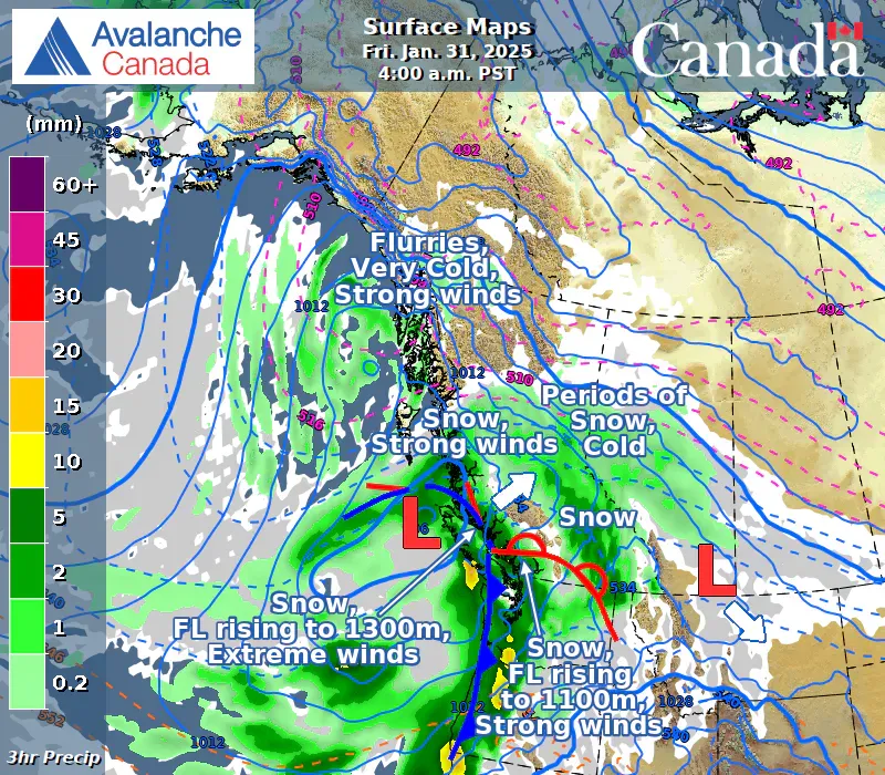
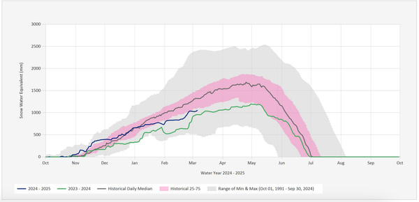
A series of low pressure systems headed our way is expected to bring both snow and plunging temperatures for the week ahead. Forecasts are for 10-30cm of new snow coming through Friday and Saturday with temperatures plunging to -10 or below over the weekend.
Looking ahead to the weekend, we're planning to dial things back in a big way. The last few weeks have been great for exploration with a largely stable snowpack, but with this new snow falling on a surface hoar and crusts, we're preparing for widespread, reactive avalanche problems.
This period after a prolonged snow drought can be one of the most challenging to manage since we have both the feeling of complacency from weeks of low hazard and the draw of fresh powder. To manage that, we adopt what the avalanche world calls a"strategic mindset" of stepping back. This means making a clear and conscious shift to only ski lower risk terrain, at least until we start to understand how this new snow is bonding with the old stuff.
Cold as a Terrain Trap
While -10 isn't that cold – I grew up skiing in -20 and below in Alberta – it's definitely colder than we're often used to here in the Cascades. And, with strong winds expected, the windchill could drive things to feel even colder.
When temperatures drop like this, we like to think of it as almost another type of "terrain trap". If you're not familiar with the term, it means something that can amplify the impact of an avalanche. In this case, it means that even a minor injury or lost/broken piece of gear can suddenly become a big problem when the temperature plunges.
We'll be adding this consideration to our trip planning while things stay colder. This might mean adjusting objectives or adding extra gear to our packs like a stove, more spare layers, emergency blankets, and potentially even a lightweight shelter for longer missions.
Upcoming Events
The sunshine and stable conditions of these past weeks had us thinking a lot about spring. For us that often means winter camping and ski traverses. That's why we are stoked for next Thursday's workshop at Mt.Waddington in Chilliwack all about these topics. We'll cover everything from shelters to food planning to how to plan and execute trips both on known and less traveled routes. Tickets are $10, all proceeds to Chilliwack SAR.
If you're interested in hands on training, we also have an overnight course focused on snow shelters and winter camping on February 22/23. This is a great chance to hone your skills, learn how to make emergency shelters and have a great night out in the snow in the North Cascades.
We also only have a handful of avalanche courses left this season. Don't miss your chance to get trained up, get your friends trained or refresh your skills!