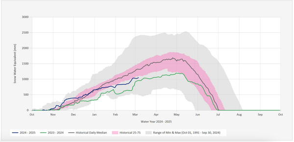
Winter is off to a strong start
It's been a minute since winter started like this in the Pacific Northwest. All across the region, the mountains are starting to turn white and fill in with snow. Here in the Fraser Valley, people have been touring up Cheam, on the Coquihalla Summit and both Manning Park and Sasquatch have shared some promising updates about early season snowpack.
That being said, it is still early in the year and lower elevations, especially in the trees, will need some more snow before it is truly game on in our corner of the North Cascades.
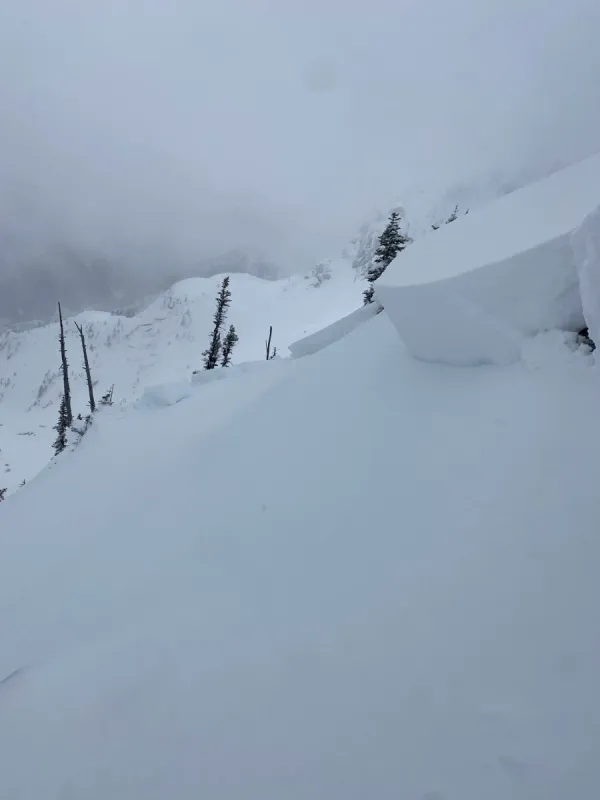
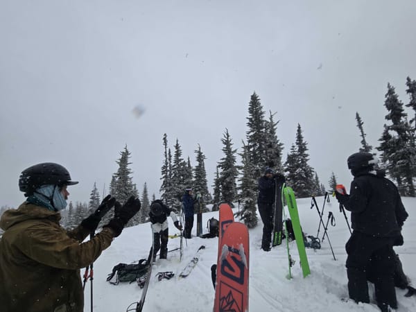
Here's what we've been seeing this past week
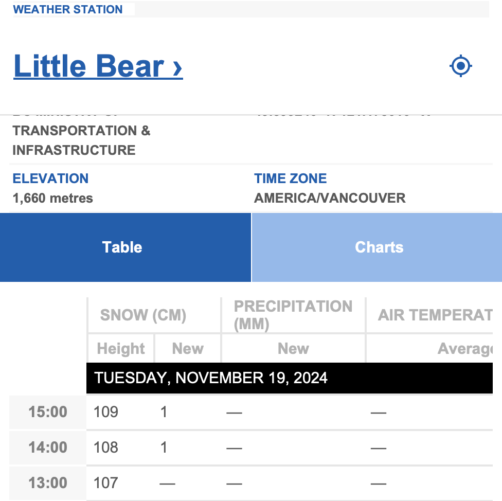
On Cheam, reports after the last storm were that the snowline had dropped to around 1200m. The road above is well filled for skinning and the mountain is starting to come into skiable form, although sharks are still prevalent in rocky and treed areas. The new snow was bonding well to the layer beneath. Weather stations are showing over 100cm at 1600m.
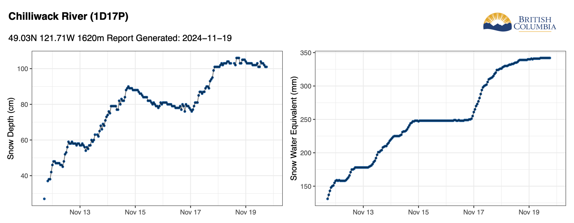
We got our first report from the Coquihalla Summit this week as well. According to a Mountain Information Network post, skiers up on Zoa found "40-50cm's" of new snow bonding well to the 20-4ocm base below it. They did mention that some rocks were still lurking just below the surface though, so be careful up there, especially in areas with tree cover or rough surfaces that need a lot more snow to fill in. According to the weather stations, there is around 50cm at the highway and 110cm's at 1600m.
Manning Park and Sasquatch Resort both shared updates this past week. With both resorts aiming for a mid December opening, Manning is reporting a 70cm base at the top of the mountain with 20cm at the bottom. Sasquatch hasn't shared a snowpack update yet.
What are we thinking about?
The weather forecast ahead is looking mixed. We have precipitation expected today and tomorrow. Beyond that there is the potential for small amounts of snow, but overall the forecast looks pretty dry and pretty cold. That could always change, but with what is in the forecast, we'll be watching for a few things.
Wind: We may not see a lot of new snow in the coming days, but we could have some winds up on the mountains that are perfect for moving snow around. Watch out for windslab formation.
Sun: The snowpack we have is still quite young and fragile. If we get a lot of sun, that could also destabilize the snow we have and increase avalanche hazard.
Coverage: It is getting close to being game on in our backyard mountains, but it's also important to remember that it takes a lot of snow, over 2 meters in some places, to bury all the rocks and wood on our mountains. I'm still taking a cautious approach until we see at least another good pulse of snow.
What's on top: We have a solid base starting to form. But, with a stretch of cold and clear weather, we could see both crusts and surface hoar start to form on top of our current snowpack. That could be the basis for a future avalanche problem, so I'll be watching that carefully as we wait for more precipitation.
As always, if any of these terms or concepts are new to you, or you just don't remember what they mean, we have a ton of avalanche courses coming up.
And, don't forget about our Avalanche Awareness and Backcountry Trip planning workshop in a few weeks. Tickets are selling fast and all proceeds from the entire workshop series will go to Chilliwack SAR.
Avalanche Forecasts Start Soon
Avalanche Canada will start releasing public avalanche forecasts on November 21st at 4:00 p.m! This is a great time to make sure you have the AvCan app downloaded on your phone. And, if you are heading out into the mountains, think about publishing a Mountain Information Network report when you get home. These reports are a huge asset to forecasters and other backcountry users. Not sure how to post one? Check out this detailed guide on MIN reports from Avalanche Canada.